Polecat Gulch Reserve
Polecat Gulch Reserve was developed in 2007. It contains over 7 miles of winding single track trails that offer outstanding views of the Treasure Valley as well as the Boise ridgeline. Trails in this area cross through lands managed by the Bureau of Land Management and the City of Boise. Please stay only on system trails. The Polecat Gulch Reserve trails are excellent beginner trails for mountain bikers due to their relatively easy grades.
Conditions
No specific conditions or closures to report.
Review our full log of trail Condition Reports for the most current information.

Projects
Cartwright Ridge Trailhead Enhancement
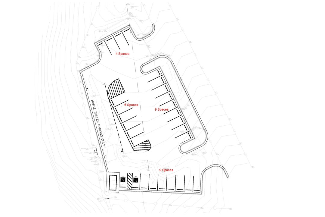
We are excited to announce a $200,000 grant from the Foundation for America's Public Lands that will support the improvement of the Cartwright Ridge Trailhead, enhancing trail access in Northwest Boise. When paired with an approved investment from the City of Boise of $300,000, this much needed trailhead project will create a dedicated paved parking area with two accessible spots, parking for horse trailers, a restroom and more. The trailhead, which is currently a dirt lot located off Cartwright Road, provides access to Polecat Gulch Reserve and Peggy's Trail. The land is owned by the Bureau of Land Management. Construction is expect to start in spring 2026.
Featured Trails
Active Filters:
Parking
This area is accessible from two trailheads:
- Cartwright Trailhead, located along Cartwright Road, .25 miles east of the junction with Pierce Park Road - 12 unpaved parking spots
- Polecat/Collister Trailhead, located at the end of Collister Road - 15 gravel parking spots
Restrooms
A vault toilet restroom is available at the Polecat/Collister Trailhead
Trail notes
- Beginner mountain bike rides
- Easy family hikes
- Wildlife
Dogs must remain on-leash at all times on Polecat Gulch Reserve trails to protect populations of the threatened Aase's Onion plant, as well as critical wildlife found in the area.
Wildlife abound in Polecat Gulch Reserve, where it is not uncommon to see deer or coyotes, as well as birds such as quail, hawks and eagles.
There are several loop options in Polecat Gulch Reserve, the longest being the 5.8 mile Polecat Loop Trail #81. This loop follows numerous finger ridges on the west side of the Reserve, before looping back through the Polecat Gulch Reserve drainage and returning via a traverse high above Cartwright Road.
Those wanting a shorter loop option can combine a portion of the Polecat Loop Trail with either Doe Ridge Trail #82 or Quick Draw Trail #83.
- Polecat Loop Trail #81 - Designated Directional - All trail users are required to travel in the same direction. Users will travel counter-clockwise through 2025. Please note, the first half-mile of the trail from the Polecat Trailhead on Collister Drive is multi-directional to provide an out-and-back experience at Polecat Gulch Reserve. In addition, the short section of Polecat Loop from Cartwright Trailhead to the lower Doe Ridge Trail junction is multi-directional to allow for shorter loops on the north side of the reserve. If the trail is muddy, it is permissible to turn around and return to the trailhead to prevent damage to the trail.
